Our Mission
CyArk is unlocking the power of 3D technology to make the world's cultural heritage accessible to new audiences and future generations.
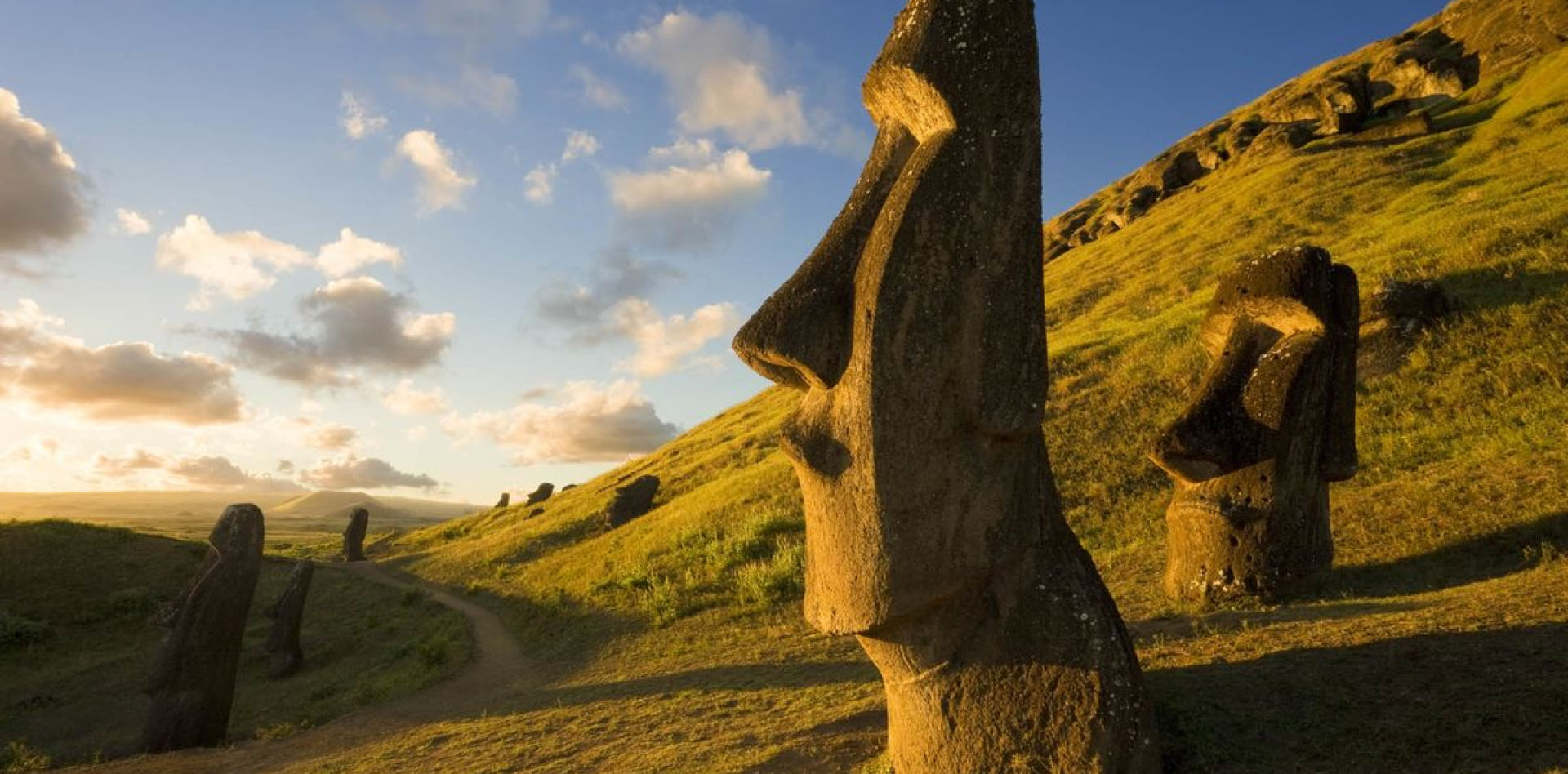
Expanding Access to Cultural Heritage for New Audiences
Everyone deserves an opportunity to engage meaningfully with cultural heritage, regardless of geography, background, or resources.
Leveraging photorealistic 3D models, immersive technologies, and a unique approach to spatial storytelling, we can reach and engage audiences with powerful stories of sites, monuments, and their connected communities.
Together with partners, we create:
Web and Mobile Experiences
Sharing cultural heritage stories through immersive, interactive platforms that are accessible worldwide on our Tapestry platform.
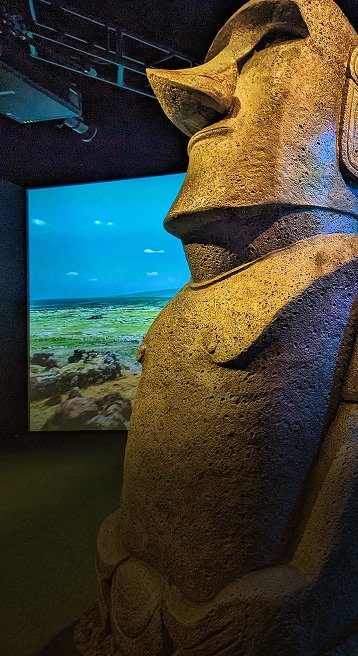
Museum Installations
Enriching traditional exhibitions by integrating dynamic, 3D storytelling experiences that captivate and educate museum visitors.
Open Access to Digital Data
Empowering researchers, educators, and creators by providing free access to high-quality digital heritage datasets for further study and creative re-use.
Impact Stories
Preserving Cultural Heritage for Future Generations
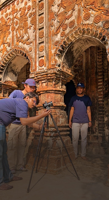
Recognizing that cultural heritage faces unprecedented threats from climate change, conflict, and rapid urbanization, CyArk has created a documentation methodology to produce photorealistic and accurate digital twins of sites that can be used for recordation and analysis.
Through detailed documentation, training, and archiving, we secure the legacy of humanity’s shared past:
Digital Twins for Conservation
Producing precise, high-resolution 3D replicas to guide restoration projects, inform disaster response, and facilitate ongoing site management.
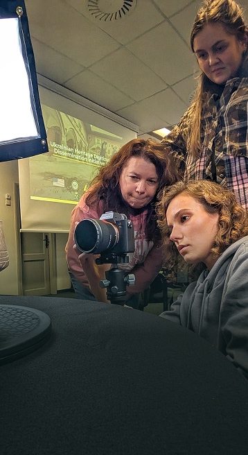
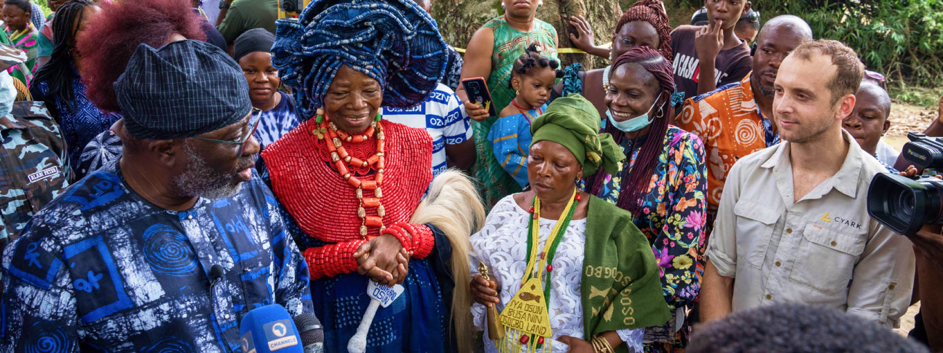
Capacity Building
Equipping heritage practitioners worldwide with the necessary skills and technologies to document, protect, and sustain their own cultural heritage.
Digital Records for Posterity
Capturing accurate digital snapshots of heritage sites as enduring records before they are irreversibly impacted or lost to climate change, conflict, or urban development.
Impact Stories
IMPACT BY THE NUMBERS
Our work seeks to have impact across a number of areas, from building digital documentation skills and capacity to making the resulting data usable, accessible and reaching new audiences.
Creating Equitable Access to Cultural Heritage
Our work seeks to expand access to cultural heritage through virtual experiences that reduce the geographic and financial barriers to visiting these places and learning their stories.
100+
Experiences Created
2,500,000+
Virtual Visitors
Building Capacity in the Cultural Heritage Sector
Virtual and in-person workshops build both hard and soft skills that support the local management and protection of cultural heritage and have broad applicability and value in numerous career paths.
2,000+
People Trained
Making Data Open and Reusable
Our work supports the broad re-use of 3D cultural heritage datasets for education, research and non-commercial purposes through the OpenHeritage3D project.
300
Datasets published
10,000+
Datasets downloaded
OUR HISTORY
CyArk was founded in 2003 by Ben Kacyra, an early pioneer in the development and commercialization of LiDAR technology and the founder of Cyra Technologies.
Over the past two decades, as technology for capturing and preserving cultural heritage has rapidly advanced, CyArk's mission has evolved accordingly.
Initially focused on developing methods for the capture and archival of heritage sites, we now emphasize unlocking the full potential of 3D data as a powerful medium for storytelling and as a vital resource supporting physical conservation efforts.
Our 20 Year Journey
Featured Partners
CyArk's continued work and impact is possible through the generous support of our donors and funders:


Help us empower connections to cultural heritage